


Votos - 2, Puntuación media: 4
(

 )
)
|
Fotos y especificaciones Sony HDR-CX250E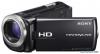 |


Otros manuales para este modelo:


Resumen del manual
If you do not want to record location information Select . [Setup] . [ General Settings] . [GPS Setting] . [Off ]. Notes . It may take a while before the camcorder starts triangulating. . Use the GPS function outdoors and in open areas, as the radio signals can best be received in such areas. . The map always displays the north at the top. Obtaining a map of the current location (triangulating priority mode) This feature is useful for checking a map of your current location while traveling. As the camcorder turns other functions off to search for satellites, obtaining triangulating information can take priority. Select . [Setup] . [ General Settings] . [Your Location]. A marker (red) that indicates your current location Displays the triangulating information (p. 43) Notes . If you select a certain point on the screen, the map shows an area with that point at the center. Select to move your current location back to the center again. . If the camcorder cannot acquire current location information, the triangulating information screen appears (p. 43). . If the location information that was previously acquired is invalid, the marker does not appear. . To close the current location screen, select . GB Checking the triangulating status Checking the triangulating status 1 Display your current location (p. 42). If your current location appears on the LCD screen, you do not need to continue this operation. 2 Select . Satellite icons Satellite map Triangulating Information for the gauge location that was previously obtained. . To close the triangulating information screen, select . On the satellite map and triangulating gauge The center of the satellite map shows your current location. You can check the direction (north/south/east/west) of the satellites with the satellite icons (.) that appear on the satellite map. When the camcorder succeeds in triagulating your location, the triangulating gauge turns to green. How to check the GPS satellite icons/ triangulating gauge The color of the GPS satellite icons and the triangulating gauge change according to the current status triangulation. GPS satellite icons/ triangulating gauge Status / (black) No signal, but orbit information for the satellite is available. / (gray) Part of the satellite orbit information has been obtained. / (brown) About a half of the satellite orbit information has been obtained. / (ocher) Most of the satellite orbit information has been obtained. / (green) Triangulating is completed and the satellite is currently being used. If data on your current location cannot be obtained A display that allows you to triangulate the location again appears. In this case, follow the instructions that appears on the LCD screen. Advanced operations GB Enjoying a digest of your movies (Highlight Enjoying a digest of your movies (Highlight . Use the GPS function outdoors and in open areas. For details on locations or situations where radio signals cannot be received, refer to the “Handycam” User Guide. . Rotate the LCD panel to direct the GPS antenna towards the sky. Do not place your hand on the GPS antenna. . Select [Your Location] in the menu to use the triangulating priority mode (p. 42). . Use GPS Assist Data. If you import GPS Assist Data from your computer to your camcorder using the built-in “PlayMemories Home” software, the time it takes the camcorder to acquire your location information can be shortened. Connect the camcorder to a computer that is connected to the Internet. The GPS Assist Data will be updated automatically. Notes . In the following situations, the current location of the camcorder shown on the map may be different from the actual location. The margin of error can be as wide as several hundred meters. .When the camcorder receives GPS signals that have been reflected off the surrounding buildings .When the GPS signal is too weak . The GPS Assist Data may not function in the following cases: .When the GPS Assist Data are not updated for about 30 days or more .When the date and time of the camcorder are not correctly set .When the camcorder is moved for a long distance . If you are using a Mac, you cannot import GPS Assist Data. GB You can enjoy a digest of high definition image quality (HD) movies and photos, similar to a short movie. 1 Press (View Images) (p. 32). 2 Display the desired event at the center of the Event View, and select [ Highlight]. Volume adjustment Context To pause To stop Previous Next Select the desired operation 3 when the highlight playback finishes. A: The camcorder plays the Highlight Playback scenes again. B: You can save the Highlight Playback scenes in standard definition . If the Highlight Playback function was started image quality (STD) and share it from the Map View screen, [Highlight Point] cannot be set. However, if the Highlight (upload it to the web, etc.). Playback function was started from the Event C: You can change the settings for View screen and you set the [Highlight Point], Highlight Playback. the p...
Otros modelos de este manual:Videocámaras - HDR-CX260VE (1.65 mb)
Videocámaras - HDR-CX570E (1.65 mb)
Videocámaras - HDR-PJ260VE (1.65 mb)
Videocámaras - HDR-PJ580VE (1.65 mb)